OverviewNearbyReviewsWin PrizesRecommended
Share to
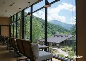
Fossamagna Park
フォッサマグナパーク2.4
 based on 17 reviews
Temporarily Closed Opening hours TBD
Address:
2484-1 Negoya, Itoigawa 949-0536, Niigata PrefectureMap
Phone+81 25-553-1880
What travelers say:

See all 4 photos
Recommendations Near Fossamagna Park
Fossamagna Park Reviews: Insider Insights and Visitor Experiences
Write a Review
 Trip.com
 (17 Reviews)TripAdvisor17 Reviews
You Might Also Like
Shin-Hotaka Ropeway
4.1
5/54 Reviews
From VND 511,168

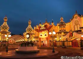
Tokyo Disneyland
9.5
4.8/59305 Reviews
From VND 1,302,654
Tokyo DisneySea
9.1
4.8/53511 Reviews
From VND 1,302,654
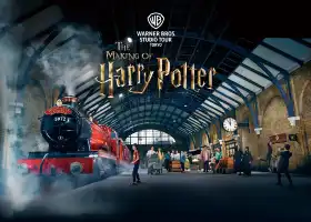
Warner Bros. Studio Tour Tokyo - The Making of Harry Potter
8.8
4.8/51227 Reviews
From VND 1,071,805
Nearby Attractions
Oyashirazu Pier Park - Furusato Activity Center | Fossa Magna Museum | Itoigawa GeoStation GeoPal | Jade Coast | Miyama Park | Benten Rock | Charmant Hiuchi | Hisui-no-Yu | Lavender Beach | Itoigawa Seaside Valley Ski Area | Amatsu Shrine | Tanimura Art Museum | 健康交流館ゆらら | Suzawa Seaside Park | Hakusan Shrine | Tsutsuishi Station | Kotakigawa Jade Gorge | Choja Hot Springs Yutorikan | Old Oyashirazu Brick Tunnel | Noukaiyo Koen Arasaki Camping Ground | Hisui Garden | Itoigawa Beach | Chojagahara Archaeological Museum | Souma Gyofū Poetic Memorial (Statue of Love) | Itoigawa Civic Center | Japan Sea Observation Deck | Itoigawa Country Club | Zendana Station | Kaibo Park
Popular Types of Attractions in Itoigawa
Parks | City Parks | Amusement Parks | Botanical Gardens | Religious Sites | Other Places of Worship | Temples | Churches and Cathedrals | Exhibition Centers | Museums | Art Museums | Art Galleries | Lifestyle | Hot Springs | Entertainment Centers | Libraries | Architecture & Landmarks | Monuments | landmark | Featured Neighborhoods | Historic Sites | Historical Sites | Castles | Cemeteries | Popular Spots | Nature | Lakes | Attractions | Mountains | Outdoor Sports
Popular Restaurants in Itoigawa
Handmade Kikuemon | Farmer's Kitchen Hidamari | Asahiro | Menya Misodoraku | Sushikatsu | Restaurant Memory House | Aun | Sushihiro | Ramen House Higashiteramachi | Rakuraku | Ramen Tonta Rendaiji Upper Parking Area | Sushi Kappo Shino | Ramen Tonta Rendaiji Pa Kudari | Zenigataono | Suikoden | Zenigata Terashima | Occhan Ramen | Fuku | Dembei | Ajisen Shioji Banya | Saishoku Dining Kyonokura | Maru-Chan | Sakanaya | Uoman Dining | Jouki Chaya | Restpia | Dining Ose | Shirafuji | Sumibi Yakitori 103 | Kappou Haruyoshi
Popular Destinations
Syracuse Travel | Portage Lakes Travel | Anaheim Travel | Changchun Travel | Puerto Rico Travel | Kauai Travel | Dublin Travel | Miami Travel | Columbus Travel | Baguio Travel | Portland Travel | Philadelphia Travel | Dhaka Travel | Zhuhai Travel | Macedonia Travel | Kos Travel | Cowley County Travel | Split Travel | Quanzhou Travel | Hapeville Travel | Neville Township Travel | Puebla Travel | Brest District Travel | Americana Travel | Zanda Travel | Morbihan Travel | Wangmo Travel | Lesbos Travel | Sodermanland Travel
Recommended Attractions at Popular Destinations
Bangkok attraction near me | Manila attraction near me | Tokyo attraction near me | Hong Kong attraction near me | Seoul attraction near me | Taipei attraction near me | Los Angeles attraction near me | New York attraction near me | Shanghai attraction near me | Kuala Lumpur attraction near me | Shenzhen attraction near me | Osaka attraction near me | London attraction near me | Singapore attraction near me | Guangzhou attraction near me | San Francisco attraction near me | Beijing attraction near me | Macau attraction near me | Bali attraction near me | Paris attraction near me | Orlando attraction near me | Jakarta attraction near me | Ho Chi Minh City attraction near me | Chicago attraction near me | Phuket attraction near me | Toronto attraction near me | Istanbul attraction near me | Cebu attraction near me | Dallas attraction near me | Seattle attraction near me
Popular Ranked Lists
Popular Family-friendly Attractions Near Zhangwu | Popular Family-friendly Attractions Near Xinjiang | Top 5 Bars in Nanchang | Popular Nightlife Districts in Dublin | Popular Nightlife Districts in Las Vegas | Top 16 Local Restaurants in Weihai | Top 14 Fine Dining in Nagoya | Popular Premium Hotels Near Kimberley | Popular Luxury Hotels in Poipu | Popular Fine Dining in Paris | Top 5 Fine Dining in Quanzhou | Top 10 Local Restaurants in Boracay Island | Popular Family-friendly Attractions Near Yantai | Top 19 Local Restaurants in Changchun | Popular Luxury Hotels Near Comarca de Tudela | Popular Luxury Hotels Near Cauayan | Top 15 Fine Dining in Venice | Popular Family-friendly Attractions Near Shilping | Popular Luxury Hotels Near Mimasaka | Popular Premium Hotels in Esbelli Mahallesi | Popular Luxury Hotels Near Kavarna | Top 6 Fine Dining in Santorini | Top 10 Award winning restaurants in Sabah | Top 20 Fine Dining in Munich | Popular Nightlife Districts in Shanghai | Popular Luxury Hotels Near Frigate Bay | Popular Luxury Hotels Near Cerdeira | Popular Premium Hotels in Benalmadena | Popular Luxury Hotels Near Thap Put District | Global Synthesis - Trip.Trends
Popular Travel Types
More Things To Do in Itoigawa
Japan eSIM | SoftBank/IIJmio Unlimited 4G High Speed data(Natural day) | Asia・Australia eSIM|AIS SIM2Fly 8 days 6GB High-speed Unlimited 5G/4G Data | Japan eSIM | SoftBank Unlimited 5G high-speed data | Japan eSIM | SoftBank Unlimited 4G High Speed Data (1 day = 24 hours) | Japan 4G SIM Card (HK, Macau, Taiwan, China Delivery Only) | One-day tour of Kamikochi, Nagoya, Japan + Hotaka Shrine Okugakuin + Kappa Bridge + Taisho Pond [Walking in Kamikochi, Jiuzhaigou, Japan + Sanctuary God's Descent | Unlock Kappa Bridge and Myojin Bridge] | [Japan] 4G Internet Card|CMI|Unlimited Data SIM Card|Number of Optional Days|Insert the card and use it|Self-pickup at Hong Kong Airport | Trip.SIM Japan, South Korea, Macau, Taiwan and many places in Asia + Australia and New Zealand 4G travel data roaming phone network card 4 days/7 days | [Unlimited Data] Japanese 4G/5G High-speed WiFi Sharer-Hong Kong Airport Pickup (Provided by WiFiBB) | Global multi-region A series eSIM|High-speed data, travel and business Internet access, optional unlimited data, optional days, QR code | Japan eSIM | KDDI, SoftBank Unlimited 4G High Speed Data | JR EAST PASS (Nagano, Niigata area) - Consecutive 5 days | dtac GO INTER eSIM|Asia, Australia, USA 10Days 6GB Unlimited Data | Global Regions eSIM|Unlimited 4G High Speed Data | [South Korea] 4G network | Unlimited traffic | Self-pickup at the airport | WiFi rental, high-speed traffic, shared by multiple people, ready to use at boot, 12H standby, 24H customer service | Japan eSIM Unlimited Data by Gohub (QR Code) | [Southeast Asia] 4G network | Unlimited traffic | Self-pickup at the airport | WiFi rental, high-speed traffic, shared by multiple people, ready to use at boot, 12H standby, 24H customer service | Japan Tateyama Kurobe Alps + Kamikochi 2-Day Tour [Two-way from Nagoya to Japan's Secret Tateyama Snow Wall | Chinese Tour Leader] | Full-Day Private Nagano Tour: Zenkoji Temple, Obuse, Jigokudani Monkey Park | 1-Day Tour from Nagano and Matsumoto Kamikochi & Matsumoto Castle | Travel through Japan to complete the Tateyama Kurobe Alps + Hida Takayama + Shirakawa-go including one hotel stay and two meals to and from Nagoya | 1-Day Snow Monkeys, Zenko-ji Temple & Sake in Nagano | 【三郎丸蒸留所】Visit the Saburomaru Distillery Japanese Whiskey Lessons | eTour de Matsumoto - Electric Bike Tour | Nagoya + Tateyama + Snow Valley + Tateyama Murodo + Kurobe Dam + Kurobe Terrace One-Day Tour [Tateyama Kurobe Custom Chartered Vehicle] | Oyaki Dumplings Making & Walking around Zenkoji Tour in Nagano | Okuhida Unlimited Ride Ticket + Shinhotaka cable car Ticket (Okuhida Marugoto Valu Ticket) | 【Japan eSIM】Japan eSIM with Unlimited High-speed Data | Japan eSIM|High-speed data, travel and business Internet access, optional unlimited data, optional days, QR code | Matsumoto Discovery - Half Day Walking Tour
About
Payment Methods
Our Partners
Copyright © 2024 Trip.com Travel Singapore Pte. Ltd. All rights reserved
Site Operator: Trip.com Travel Singapore Pte. Ltd.
Site Operator: Trip.com Travel Singapore Pte. Ltd.
It shows that Japan was divided into 2 in the past.
There is a parking lot about 5 by car from the Fossa Magna Museum, and there is a parking lot about 10 minutes walk from there to see it in front of you, or park your car on a farm road separated by a narrow river and see it from a place about 100 meters away. Two ways to see There is. It was raining, so I visited the "cross-section map showing that Japan was divided into 2" in Fossa Magna Park in the latter way. I put a plate with "East" and "West" in an easy-to-understand manner, so I can see where to see immediately ...
I feel the history of the earth (mainland Japan) in fossa Magna (big groove).
I feel the history of the earth (mainland Japan) in fossa Magna (big groove). Fossa Magna (big groove) is the area of itoigawa ~ Shizuoka structural line, Kashiwazaki ~ Chiba structural line, Shibata ~ Koide structural line, and the new rock (16 million years ago) part. Other areas in mainland Japan are old rocks It seems that it was (27 million years ago). Itoigawa ~ You can see one end of the Shizuoka structural line (fault outcrop fault exposure) at this "Fossa Magna Park" ...
Fossa Magma Park
I was surprised because the color of the ground that divides the east and west of Japan is different. From the parking lot of National Highway 148, walk quite a bit across the bridge on the Oita Line. Also, please note that the parking lot along National Highway 148 is surprisingly small. I saw a mountain of Nechi Castle Ruins across the street.
500 m not much from the parking lot along the national highway
From ski resorts such as Hakuba in Nagano Prefecture, I headed for the Itoigawa River on National Highway 148. The aim is Fossa Magna Park. In front of the parking lot, there was a large sign saying "Fossa Magna Park" and there was a parking lot along the road on the right. From there to Fossa Magna Park, there are more than 500 m. I went up a gentle uphill like a promenade. As it is also in the textbook, "Itoigawa - Shizuoka Structural Line" is at the western end of Fossa Magna, and its length is about 2 ...
and the color of the rocks is different at the boundary.
I was running from the direction of Hakuba to the Itoigawa River on National Highway 148. A few kilometers away from the city of Itoigawa, there was a signboard for Fossa Magna Park. There was a parking lot along the road, but the number of cars that can be parked is small. From the parking lot, you will enter the mountains. On the way, there are signs and explanations about Fossa Magna, so I walk a little, but it's not painful. Eventually, I arrived at the place where the fault was exposed. "East" ...