5/5
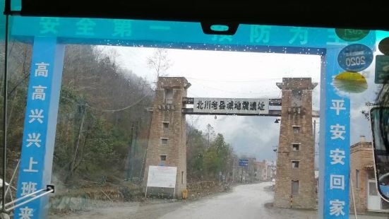
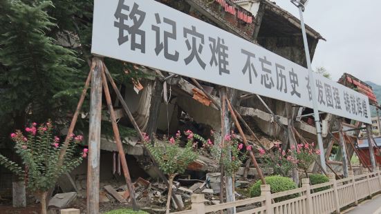
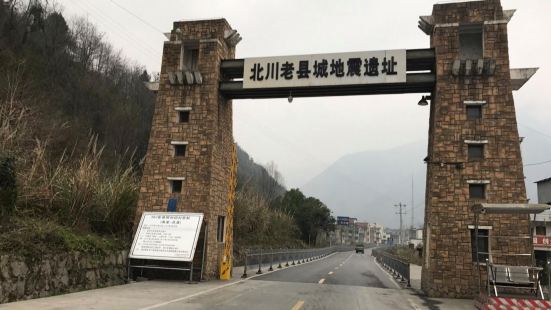
北川地震遗址位于四川省北川县,东接江油市,南邻安县,西靠茂县,北抵松潘、平武县,面积2867.83平方公里(国土详细面积2869.18平方公里)。县人民政府暂时驻安县安昌镇 ,辖4个镇。整个地震遗址博物馆项目由遗址区和博物馆共同组成,《方案设计》将北川遗址博物馆规划范围分为三个层次,分别为核心区、控制区和协调区。建议县城和任家坪都应纳入保护的核心区,其中县城整体作为遗址区,博物馆设在任家坪。 刘闲人
刘闲人0
The Beichuan earthquake site is adjacent to Jiangyou City in the east, Anxian County in the south, Maoxian County in the west, Songpan and Pingwu County in the north, covering an area of 2867.83 square kilometers. The entire earthquake site museum project is composed of the site area and the museum. The "Planning Design" divides the planning scope of the Beichuan Site Museum into three levels, namely the core area, the control area and the coordination area. It is suggested that both the county seat and Renjiaping should be included in the core area of protection, of which the county seat as a whole is the site area, and the museum is located in Renjiaping. Although Renjiaping is about 2 kilometers away from the county seat, many touching deeds also occurred during the entire earthquake relief process due to the overall collapse of the teaching building of Beichuan Middle School. Based on the above reasons, the "Planning Design" defines the planned core area as the main functional scope of the site museum project, including the earthquake site within the county seat and the Renjiaping area. Specifically, it consists of three parts, including Renjiaping Earthquake Museum and comprehensive service area, Beichuan county site protection area, secondary disaster display and natural recovery area. The control area is not only an environmental protection and ecological restoration area, but also mainly includes the main secondary disaster occurrence areas around the core area. Through ecological restoration, this area will form the background of the overall environment of the core area. The control area is about 1 km outside the environmental protection and ecological restoration area, and factors such as the distribution of surrounding settlements and the division of natural watersheds are considered.
刘闲人