


1 / 7


Mentioned in This Moment
2557 attractions | 25 posts
China
View
Real Jewel: Pinganxia hidden Forest Temple
Benjamin Sch.

Ho Pui Reservoir
Syl.vi.a Chang
A world to see
Luqyana
Conquering Mount Kinabalu!
Ron_1215
Chalaadi Glacier
KeYinWander
Vancouver Travel Journey
Escape with Emm
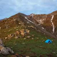
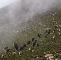
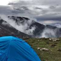
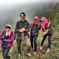
Bale mountains Trekking Tours Ethiopian Tours
Bale Mountains Brilliant Tours
Popular Trip Moments
Shaqiong Temple || The sacred sounds from the cliff | Located in Qinghai | Escape from the City Plan | Natural Oxygen Bar? | The hometown of colored pottery next to the hometown of colored pottery (Haidong) | You must always come to see the Twelve Turns in Huzhu, Qinghai | Summer and National Day travel guide to Zhalonggou Scenic Area in Qinghai | Northwest Five Provinces (Regions) Autumn Self-driving Tour (60): Visit to Liuwan Painted Pottery Museum | Xiaqiong Temple in Haidong, Qinghai | The scenery of Beishan in Mutual Aid, Qinghai | Gutham Temple, an ancient Tibetan Buddhist temple on the Qinghai-Tibet Plateau | Zhangga Mosque in Xunhua, Qinghai | Qinghai Hualong Jianzha Mani Temple | Autumn in Zhalonggou, Huzhu County, Haidong City | Ningba Ancient Village in Xunhua, Qinghai | Qinghai Seven-color Flower Sea | Real Jewel: Pinganxia hidden Forest Temple | Climbing Mount Huabao
Popular Travel Types
Popular Destinations
San Francisco Travel | Monmouth County Travel | Guangzhou Travel | Singapore Travel | San Diego Travel | Toronto Travel | Hohhot Travel | Zhengzhou Travel | Moscow Travel | Milwaukee Travel | Taipei Travel | Sanya Travel | Montego Bay Travel | Illinois Travel | Changchun Travel | Erlanger Travel | Ha Long Bay Travel | San Juan Bautista Travel | Richmond Travel | Hakusan Travel | Estrela Travel | Warsaw Travel | L'Alt Urgell Travel | Tolland County Travel | Kyaukse Travel | Herzogtum Lauenburg Travel | Damansara Travel | Ringwood Travel | Ganges Township Travel
Recommended Attractions at Popular Destinations
Bangkok attraction near me | Tokyo attraction near me | Manila attraction near me | Hong Kong attraction near me | Taipei attraction near me | Seoul attraction near me | Los Angeles attraction near me | New York attraction near me | Shanghai attraction near me | Kuala Lumpur attraction near me | Shenzhen attraction near me | Osaka attraction near me | Singapore attraction near me | London attraction near me | Guangzhou attraction near me | San Francisco attraction near me | Beijing attraction near me | Macau attraction near me | Bali attraction near me | Paris attraction near me | Ho Chi Minh City attraction near me | Orlando attraction near me | Jakarta attraction near me | Chicago attraction near me | Phuket attraction near me | Toronto attraction near me | Istanbul attraction near me | Dallas attraction near me | Cebu attraction near me | Seattle attraction near me
Popular Attractions
Jakarta Aquarium & Safari | Shark Reef Aquarium at Mandalay Bay | Mutianyu Great Wall | Aquaria KLCC | The Bund | The Peak | Yves Saint Laurent Mansion | Yokohama Hakkeijima Sea Paradise | Yu Garden | Ocean Park Hong Kong | Universal Beijing Resort | Kuala Lumpur Tower | Carnival Magic Phuket | American Museum of Natural History | Mosque-Cathedral of Córdoba | Yokohama Cosmoworld | Royal Palace Amsterdam | Sky Tower | Grand Canyon West | Gazelle Medical Spa and Aesthetics | Just Wake - Tattershall Water Park | TUGU GARUDA SAKTI | Haibin Culture Square | Eglise Saint Paul | Malan Bai Mandir | Waldemarturm | The Flying Mouse Brewery | Grunwald | Loi Kroh Boxing Stadium | Phuket Aquarium
Popular Restaurants in Haidong
SHUI YUAN SHAN ZONG WEN HUA SHENG TAI YUAN | 德克士 | 大团结柴火鸡(平安店) | Mingrenjucha Restaurant | 苏莱曼茶餐厅 | 老字号鸡肉面片王 | 老灶柴火鸡 | 三盛羊羔肉 | 汉堡王(曹家堡机场店) | 小西湖牛肉拉面 | 清真·成义牦牛壮骨汤 | 伊阑泽大循化餐厅 | 德克士(互助店) | SAI JI XI BING HU ZHU DIAN | 君祥源农家乐 | 苏格 | 京穆兰牛肉面(车管所店) | 海东国际酒店·餐厅 | 金福酒家(新平大道店) | 海东凯博酒店·餐厅 | 森林雨火锅(互助店) | A里蛋糕(乐都店) | 小圆门餐饮 | WEN ZHOU BA ZHEN SHOU SHI CHENG FU MIN JIE DIAN | 撒拉尔绿色山庄 | 绝味鸭脖(民和义乌商城店) | 海东昆仑国际酒店·餐厅 | Genjudilaotuzaochaihuo Chicken | 特色家宴 | 彩虹美农家院
Popular Ranked Lists
Popular Family-friendly Attractions Near Chifeng | Popular Premium Hotels in Anning | Top 10 Bars in Auckland | Popular Premium Hotels Near Tumbaya | Popular Luxury Hotels Near Merida | Popular Fine Dining in Shanghai | Popular Family-friendly Attractions Near Pengshui County | Top 4 Nightlife Districts in Tokyo | Popular Nightlife Districts in Jinghong | Popular Family-friendly Attractions Near Shangsi | Top 23 Light Bites in Nara | Top 10 Clubs in Tbilisi | Top 7 Fine Dining in Dalian | Top 5 Nightlife Districts in Bangkok | Popular Nightlife Districts in Chengdu | Popular Family-friendly Attractions Near Yuanan | Popular Family-friendly Attractions Near Xingren | Popular Family-friendly Attractions Near Tianshui | Popular Premium Hotels in Block Island | Top 4 Bars in Semporna | Popular Nightlife Districts in Pattaya | Popular Nightlife Districts in Dublin | Popular Nightlife Districts in Taipei | Popular Nightlife Districts in Jinghong | Popular Nightlife Districts in Las Vegas | Popular Nightlife Districts in Shanghai | Popular Nightlife Districts in London | Popular Nightlife Districts in Seoul | Popular Nightlife Districts in Beijing | Popular Nightlife Districts in Chengdu
About
Payment Methods
Our Partners
Copyright © 2024 Trip.com Travel Singapore Pte. Ltd. All rights reserved
Site Operator: Trip.com Travel Singapore Pte. Ltd.
Site Operator: Trip.com Travel Singapore Pte. Ltd.