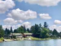
The Alawi Canal is very forced from Waikiki. Although it is a canal, it is still a relatively wide river. The scenery on both sides of the canal is good. There are modern buildings and beautiful natural landscapes.
;
Ala Wai Canal Review
4.4 /519 Reviews


1 / 3

5/5
Ala Wai Canal
Posted: Dec 15, 2019
Like
 4/5ExcellentOriginal Text
The canal is not very long, there are many small towns on both sides, the river here is very wide, did not see the transport boat passing by this, there are many interesting small things on the river, tourists who come here also like to enjoy the scenery.
Posted: Mar 19, 20200 4/5ExcellentOriginal Text
The Alaway Canal is much wider than our Beijing-Hangzhou Grand Canal, and the Haihe River is very clean, but the canal is not long. Very short one. The canal is not a scenery to see, but the surrounding is more lively, and there are many places to eat.
Posted: Jan 13, 20200 5/5OutstandingOriginal Text
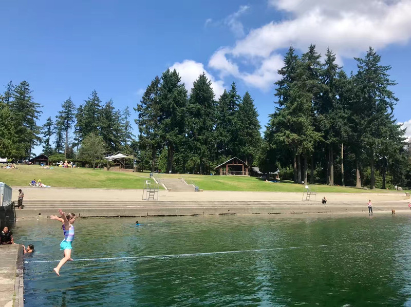
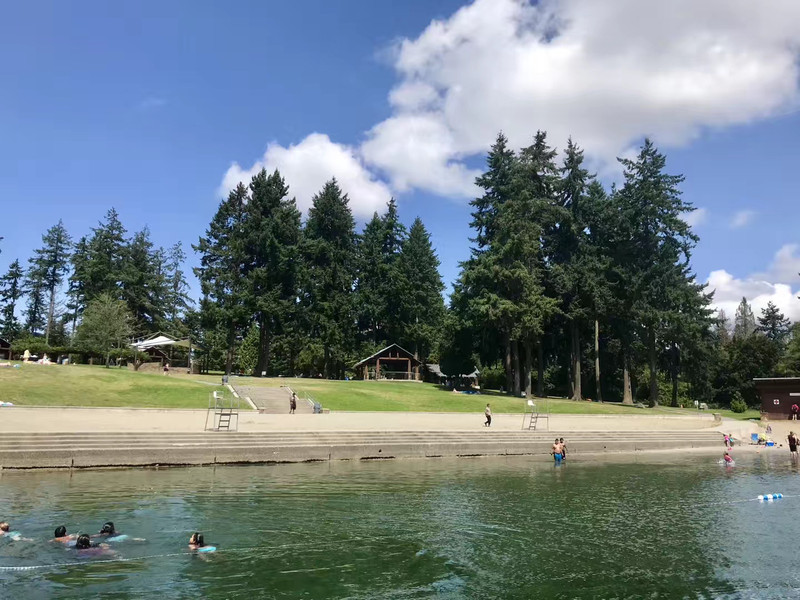
Ala Wai Canal, the Allawi Canal, or the Allawi Canal, an artificial canal in Honolulu. The canal is the northeast border of the Waikiki region. Usually visitors mention Honolulu and think of the famous Waikiki, the Waikiki region between the Alawi Canal and the Pacific Ocean, south and southwest of the canal, while Waikiki's west and southwest are adjacent to the Pacific Ocean. The Alawi Canal, which runs through Waikiki District, opens at Lake Kahanamoku (Kahanamoku Lagoon) and Port Alawi (Ala Wai Harbor), first east, after crossing the Alawi Avenue (the Avenue Bridge crosses the canal), then starts to turn southeast, all the way to the Waikiki-Kapahulu Public Library (Waikiki-Kapahulu Public Library), from the map, End there. Of course, more precisely, the reverse is the starting point of the tributary and the end point of the port of Alawi. The canal is in the section of the port of Alawi "open" east, which is the broad Alamora region to the north and the broad Waikiki region to the south. The canal was built in 1921 and completed in 1928. It has been dredged three times since then, in 67, 1978 and 2002; The purpose of the canal was to drain, when Waikiki area was covered with marshlands and rice fields, and later became a flood dischargeway in the central and eastern parts of Honolulu city. There are three roads across the canal: McCullough Street (McCully Street), Kalkaua Avenue ( Ala Moana Boulevard), Alamona Avenue ( Ala Moana Boulevard). Between the three bridges, the riverside road that stretches along the canal is called the Alawi Corridor or the Alawi Trail (Ala Wai Promenade). The promenade or the trail is a good place for an empty and quiet walk. Sometimes people fish by the bridge, some jogging... In my opinion, the situation is more interesting than the beach.
Posted: Aug 22, 20190 4/5ExcellentOriginal Text
Located on the left side of Waikikiki Beach, the Arawi Canal is a man-made river, more than 100 meters wide and about three kilometers long. It runs northwest along the northern boundary of the tourist area and into the Pacific Ocean. The river is spacious and clear. On both sides of the canal, there are many hotels and shopping malls. There are several bridges across the canal. It's quiet and a good place for a leisure walk.
Posted: Jun 16, 20183 4/5ExcellentOriginal Text
You can see it from the window of our room in Waikikiki Island colony. Go out and turn right to the canal. The Ala Wai Canal Canal is the northern boundary of the Waikikiis tourist area, traveling southwest to the Pacific Ocean. The river is spacious and clear. High-rise buildings and fancy small houses stand on both sides of the canal. There are several bridges across the canal. Walking along the canal, breathing fresh air, or doing morning exercises is also good.
Posted: Nov 20, 20152- 1
- 2
- 3
- 4
Popular Destinations
Qinhuangdao Travel | Doha Travel | Seoul Travel | Spain Travel | Nashville Travel | Baltimore Travel | Hong Kong Travel | Fort Myers Travel | Venice Travel | Florida Travel | Boston Travel | Houston Travel | Atlanta Travel | Wuhan Travel | Iloilo City Travel | Fort Morgan Travel | Tehachapi Travel | Puchong Travel | Bar Harbor Travel | Abuja Travel | Ajax Travel | Hailar Travel | North Fayette Township Travel | Vologda Oblast Travel | Center Grove Travel | North Wildwood Travel | Santa Fe County Travel | Wellingborough Travel | Vega de Granada Travel | Saarbruecken Travel
Recommended Attractions at Popular Destinations
Bangkok attraction near me | Tokyo attraction near me | Manila attraction near me | Hong Kong attraction near me | Taipei attraction near me | Seoul attraction near me | Los Angeles attraction near me | New York attraction near me | Shanghai attraction near me | Kuala Lumpur attraction near me | Osaka attraction near me | Shenzhen attraction near me | Singapore attraction near me | London attraction near me | Guangzhou attraction near me | San Francisco attraction near me | Beijing attraction near me | Macau attraction near me | Bali attraction near me | Paris attraction near me | Orlando attraction near me | Ho Chi Minh City attraction near me | Jakarta attraction near me | Chicago attraction near me | Phuket attraction near me | Toronto attraction near me | Fukuoka attraction near me | Istanbul attraction near me | Dallas attraction near me | Cebu attraction near me
Popular Attractions
Palau de la Música Catalana | Salvador Dalí House Museum | Disney California Adventure Park | SeaWorld San Diego | Universal Studios Hollywood | Vana Nava Water Jungle | The Centre Pompidou | Niagara Falls | The National September 11 Memorial & Museum | Singapore Flyer | Golden Gate Bridge | Ghibli Museum | Palace of Versailles | Impression Sanjie Liu (Evening Showtime) | Miami Beach - South Beach | Genting Highlands | Leaning Tower of Pisa | Elephant Jungle Sanctuary Samui | Mandir | Masjid Universitas Borobudur | Eklavya Stadium | TSV Heimbuchenthal | Al Noor Mosque | Shiv Mandir | Argentiera mine | Robertson mosque | Wongabel State Forest Walking tracks | Sakuradai Daiichi Park | Cité du Vin | Fujiko F. Fujio Museum
Popular Travelogues
Bangkok Travelogue | Tokyo Travelogue | Manila Travelogue | Hong Kong Travelogue | Taipei Travelogue | Seoul Travelogue | Los Angeles Travelogue | New York Travelogue | Shanghai Travelogue | Kuala Lumpur Travelogue | Osaka Travelogue | Shenzhen Travelogue | Singapore Travelogue | London Travelogue | Guangzhou Travelogue | San Francisco Travelogue | Beijing Travelogue | Macau Travelogue | Bali Travelogue | Paris Travelogue | Orlando Travelogue | Ho Chi Minh City Travelogue | Jakarta Travelogue | Chicago Travelogue | Phuket Travelogue | Toronto Travelogue | Fukuoka Travelogue | Istanbul Travelogue | Dallas Travelogue | Cebu Travelogue
Popular Ranked Lists
Popular Premium Hotels Near L'vivs'ka city council | Popular Family-friendly Attractions Near Wenan | Popular Fine Dining in London | Popular Family-friendly Attractions Near Jingning | Popular Luxury Hotels Near Alcudia | Top 7 Fine Dining in Dalian | Popular Premium Hotels Near Samosdelka | Popular Luxury Hotels Near Maafushi | Popular Luxury Hotels Near Santa Ana | Top 5 Bars in Guilin | Top 20 Local Restaurants in Las Vegas | Top 6 Bars in Queenstown | Popular Luxury Hotels Near Puerto Manzano | Popular Family-friendly Attractions Near Tianzhu | Top 9 Clubs in Barcelona | Popular Family-friendly Attractions Near Shangyou | Popular Luxury Hotels Near Herzlake | Popular Nightlife Districts in Las Vegas | Top 12 Fine Dining in Changsha | Popular Fine Dining in Paris | Top 4 Nightlife Districts in Tokyo | Top 4 Nightlife Districts in Osaka | Top 5 Nightlife Districts in Bangkok | Popular Nightlife Districts in Dublin | Popular Nightlife Districts in London | Popular Nightlife Districts in Seoul | Popular Nightlife Districts in Chengdu | Popular Nightlife Districts in Jinghong | Popular Nightlife Districts in Shanghai | Popular Nightlife Districts in Hong Kong
About
Payment Methods
Our Partners
Copyright © 2024 Trip.com Travel Singapore Pte. Ltd. All rights reserved
Site Operator: Trip.com Travel Singapore Pte. Ltd.
Site Operator: Trip.com Travel Singapore Pte. Ltd.