
Best Xiaojin Hotels
Enter your dates for prices and availability of the best hotels in Xiaojin.
Hot travel dates
Today
Tomorrow
This Weekend
Next Weekend
Mar 2025
- Sun
- Mon
- Tue
- Wed
- Thu
- Fri
- Sat
- 1
- 2
- 3
- 4
- 5
- 6
- 7
- 8
- 9
- 10
- 11
- 12
- 13
- 14
- 15
- 16
- 17
- 18
- 19
- 20
- 21
- 22
- 23
- 24
- 25
- 26
- 27
- 28
- 29
- 30
- 31
Apr 2025
- Sun
- Mon
- Tue
- Wed
- Thu
- Fri
- Sat
- 1
- 2
- 3
- 4
- 5
- 6
- 7
- 8
- 9
- 10
- 11
- 12
- 13
- 14
- 15
- 16
- 17
- 18
- 19
- 20
- 21
- 22
- 23
- 24
- 25
- 26
- 27
- 28
- 29
- 30
Swipe up to view more
Filter by:
Hotel Star Rating
≤2345
Popular Filters
Amazing 4.5+Great 4.0+Good 3.5+Pleasant 3.0+567 Best Hotels to Stay in Xiaojin
Select your travel dates for best hotels in Xiaojin, featured by Trip.com based on guests reviews!
Most Booked
Lowest Price
Closest to Downtown
Highest Rated
Hotel near Xiaojin
GGuest User 2023.11.14
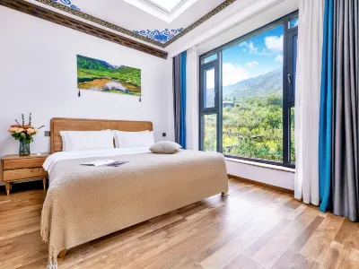
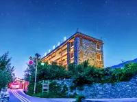
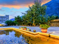
This is my second time staying here. The room is clean and the environment is very nice and quiet. I really like the hillside village where the B&B is located, so I took a lot of pictures haha. The window is very close to the mountain and has a great view. There is a skylight to see the stars. I am very lucky to live here. I saw the starry sky and the Milky Way both nights (I couldn’t take pictures with my mobile phone, so I could only take pictures of the brightest ones, and I even found the constellations and drew them myself haha). The boss was very helpful and turned off the lights in the B&B so that we could stay in the hotel. Watch the stars on the rooftop. Before I left, I bought three boxes of Xiaojin apples, which were delicious. I would like to stay here next time. I wish the boss a prosperous business!
Perfect
169 reviews
4.9/5
Price from
$33
per night
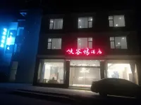

Hotel near Changping Valley/Ethnic Customs Street,Xiaojin 9.1% of visitors choose this area
GGuest User 2024.07.13
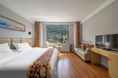
The boss is very cheerful and enthusiastic, the hygiene is good, and the stay is quite comfortable. I came here with my friends. The experience this time was very good. I will book this hotel next time.
Very Good
72 reviews
4.2/5
Price from
$14
per night
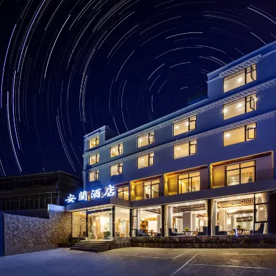


Hotel near Changping Valley/Ethnic Customs Street,Xiaojin 9.1% of visitors choose this area
GGuest User 2023.08.16
Anlan Hotel: Recommend
Stayed here for 2 nights while visiting Mt. Siguniang. Not the best location. It is located just over a kilometre west of Chaoping Valley. So most restaurants are a short 5-10 minute walk east. If you have a car/motorbike: location is not a problem.
Hotel room was satisfactory. Nice big comfortable bed. Very clean. Good air conditioning. Balcony with mountain view. Nice bathroom/bathtub. Interesting towels...
Staff were nice and friendly/helpful. Helped to arrange a private taxi back to Chengdu. And when our driver was late for pick up, the owner let us return back to the hotel room to wait comfortably. That was nice.
Overall, had a good experience. Recommend Anlan Hotel for a weekend stay while visiting Four Sisters'.
Excellent
259 reviews
4.5/5
Price from
$21
per night

You Might Like
Xiaojin Hotels With BreakfastXiaojin Hotels With Twin RoomXiaojin Hotels With 1 Double BedXiaojin Hotels With Swimming PoolXiaojin Hotels With Free Cancellation
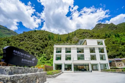
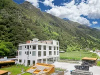
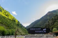
Hotel near Xiaojin
DDelikedashu 2024.11.30
The location is very good, on the only way to get in and out of the Jiesigou, the room is relatively good in comparison, there is a fireplace heating and projection. But there are not many places where the overall room can put things, there is no warm air in the bathroom bath, and the bath is a bit cold at this time. The breakfast was very rich.
Outstanding
4 reviews
4.7/5
Price from
$58
per night

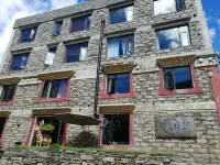

Hotel near Changping Valley/Ethnic Customs Street,Xiaojin 9.1% of visitors choose this area
MMildmap 2024.11.24
The pin on the map (ours) is not the location of the hotel. The hotel is opposite the pin. It is on the same curve up and down the road. The room is clean, ok, not very soundproof. There is a heater on the floor, warm blanket, no elevator. When checking in, the staff helped carry the bags. There is a cat in the accommodation. We arrived at the hotel late at night. At first, we couldn't find the hotel because the pin was in a different building. So we asked a Chinese person who happened to be walking by. He was very helpful. He took us to check in. He was cute. In the morning, we woke up and went down to check out. We were waiting for the car in front of the hotel. We met someone from last night and she greeted us in a very friendly manner. The people are really cute.
Excellent
576 reviews
4.4/5
Price from
$20
per night
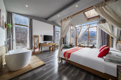
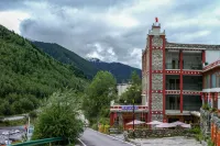

Hotel near Changping Valley/Ethnic Customs Street,Xiaojin 9.1% of visitors choose this area
GGuest User 2024.06.11
Pet-friendly hotel, the proprietress is beautiful, generous and enthusiastic. The peony flowers planted in the yard are very beautiful, and there are many succulents, but unfortunately I didn't have time to take pictures. The hotel is in a good location, very close to the gate of the scenic area, and it only takes two minutes to walk. There is a parking space at the entrance of the hotel, as long as it is not full, you can park on a first-come, first-served basis. There is an elevator without climbing stairs. The room is relatively large, the bed is also large, and there is floor heating.
Excellent
162 reviews
4.4/5
Price from
$24
per night


Hotel near Changping Valley/Ethnic Customs Street,Xiaojin 9.1% of visitors choose this area
XXiaodai666 2024.12.17
A very pleasant experience of staying in Siguniang Mountain in autumn. The B&B has a large room with complete facilities. Breakfast is provided attentively. There is floor heating in the room, and the humidifier is very suitable for the temperature difference between autumn and winter. There is also a paid oxygen concentrator for emergency use.
The B&B has a particularly advantageous location. It is just a few steps away from Changpinggou. This is the only place where tourists can see the whole picture of Siguniang Mountain. Yaomei Peak is particularly good for photos. It is also very fast to take a taxi from the B&B to Shuangqiaogou, about a quarter of an hour. There is a local specialty sales car at the door of the B&B. It is within 5 minutes from popular restaurants and coffee shops. It is just up the stairs next to the dining and food street. It is really super convenient👍.
Outstanding
246 reviews
4.7/5
Price from
$45
per night


Hotel near Changping Valley/Ethnic Customs Street,Xiaojin 9.1% of visitors choose this area
GGuest User 2024.09.15
This is my first time to write a review because I am super satisfied! ! Very good value for money!
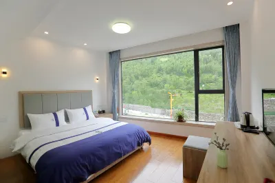
1. First of all, the room facilities are very smart, very new, and have floor heating. They are clean and tidy! Towels, face towels, toilet mats, etc. are all provided by the boss as disposable ones (I believe that those with mysophobia and those who need quiet can wash their hands without thinking). My friends and I all slept really well.
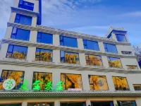
2. The location is very good. There are restaurants within a few minutes' walk, which is very easy to take pictures. It is also very close to the scenic spot!
3. The boss is super nice and his service attitude is excellent! ! We were very tired when we came back from the meal. The boss took the initiative to use the oxygen concentrator for us to breathe oxygen. He also actively helped us find a place to charge the car🔋. In the end, I didn’t even remember that I left the things in the hotel. The boss also called to help me mail them. I love the boss so much! ❤️
By the way, the hotel also has ******* costumes that you can try on and take pictures for free, hahaha, they look very nice.
Outstanding
95 reviews
4.7/5
Price from
$35
per night

Hotel near Changping Valley/Ethnic Customs Street,Xiaojin 9.1% of visitors choose this area
GGuest User 2024.09.17
When traveling during the Mid-Autumn Festival, it is normal to pay a premium for a room with more passengers. In addition to the appropriate hardness of the bed in the room, the following problems were discovered: 1. The so-called starry sky room booked for a fee has an extra piece of glass on the top of the bed. The curtains on the ceiling are as shown in the picture. First Not to mention whether there is a view (the weather is bad, of course there is nothing to see, and the room is backed by a mountain without any view.), the zippers are not tight enough, and the light shines directly into the eyes early in the morning. 2. I was given a room card at the time, but the door was open when I entered. The room did not have a lock or anti-theft chain, which made me feel a little uncomfortable. 3. The hygienic condition is average. There is still toothpaste on the washing cup. The friend's room next door even had the toothpaste used by the previous guest in a cup (not photographed). 4. The newly vacant room I lived in at that time did not have disposable slippers, and there was only one pair of sandals. If two people lived there, the other person would not be able to use them. As a hotel in a scenic spot, its operation is not likely to be affected by the off-peak and peak seasons, but as an accommodation industry, please better improve the hygiene and maintenance of inn facilities and equipment.
Excellent
251 reviews
4.5/5
Price from
$24
per night



Hotel near Shuangqiao Valley/Shuangdiao Village,Xiaojin 6.2% of visitors choose this area
Xx-yill 2024.12.04
The hotel is in a good location with convenient transportation. It is right next to the Shuangqiaogou scenic area and is equipped with charging stations. I highly recommend the beef soup pot. It is very filling, tastes good, and the price is reasonable. There are many varieties of porridge, steamed buns, and eggs for breakfast.
Excellent
1673 reviews
4.5/5
Price from
$27
per night
What Travelers Said About the Best Hotels in Xiaojin
See all
Browse these genuine traveler ratings and real guest reviews to find the best Xiaojin hotels.
4.9/5
Perfect
JJiraphonI must say that before traveling, we were quite worried about many things in this country, such as the people, the bathrooms, the cleanliness, etc. (It was all our own thoughts, listening, and imagination). But that was not an obstacle to our decision to travel this time…..
When we arrived at Siguniangshan, let everyone imagine… It’s like a community deep in the mountains, about 4-5 hours away from the city. The atmosphere in the village is similar to Ban Rak Thai in Mae Hong Son mixed with Hmong or something on a high mountain. The public bathrooms
We weren’t that worried **There might be some places along the way that were a bit brutal😅
We arrived in front of the hotel where we were going to stay and found it quiet both in front of the hotel and inside the hotel. We started to feel, “Huh! What’s going on?” until our driver shouted something in Chinese. Suddenly, a woman suddenly appeared from the kitchen, wearing an apron and gloves, with a friendly smile on her face, greeting and welcoming us warmly.
(I can say this because Today, when we write this post, we are already on our way back.)
And I must say that every day that we stayed at this accommodation throughout our trip (3 nights), we were taken care of at every step by this woman. Whether it was food, picking us up and dropping us off, recommending restaurants, being an interpreter, finding us a taxi, etc., there were so many more. If we were to describe it, it would be impossible (we guess that this woman is probably the owner of the hotel who takes care of everything in the hotel herself).
If one day we have the chance to come back here again, we definitely won't hesitate to stay here.
”Relax your mind, accept the mountains, and the mountains will accept you.” It's ”adjusting”.
These are the words of that woman..!!! My heart is full 🥰
Siguniang Mountain Qingfeng Xiaozhu Homestay
Hotel near Changping Valley/Ethnic Customs Street, Xiaojin 9.1% of visitors choose this area
Price per night from:$32
4.9/5
Perfect
GGuest UserAfter comparing for a long time, I chose this hotel. I was really surprised after checking in. The boss was very nice and gave the children hot milk. The room was very new and fully intelligent. The children liked it very much. It was also very clean. There was an oxygen concentrator and the floor heating was also very powerful. You can see the mountain view in the room. It is very beautiful in autumn. If I go to Siguniang Mountain next time, I will choose to stay in this hotel.
Shaorui Intelligent Hotel
Hotel near Changping Valley/Ethnic Customs Street, Xiaojin 9.1% of visitors choose this area
Price per night from:$29
4.8/5
Outstanding
GGuest User-staff can speak english
-staff can help you book your return bus to chengdu
-staff can send you to bus station if the bus cannot pick up infront the hotel
-they have a small cafe & restaurant at the hotel lobby
-staff can help you book taxi to shuangqiao valley
-good floor heating system
-need to be at the hotel before 10pm..if not you cannot enter the hotel
chang ping inn
Hotel near Changping Valley/Ethnic Customs Street, Xiaojin 9.1% of visitors choose this area
Price per night from:$23
4.8/5
Outstanding
PPanatsaThis hotel was far beyond what we expected. We stayed here for 2 nights in the room with the floor heater on the 3rd floor where we could get the breathtaking view of Siguaningshan right from our room.
The hotel room was very nice, cozy, comfy and very clean. In the room, they provided everything you might need esp. the Oxygen generator.
The staffs were very helpful, service minded and nice. They tried to help us to manage the transfer, to order some food with the handy translator. That was great.
This hotel was not in the downtown but the hotel provided the transfer for us with the very polite driver.
And this hotel had so many picturesque and scenic photo spots for us taking lots of photos. And we enjoyed it so much.
And for food, they had Western and Chinese food and they had bar as well.
We highly recommend this hotel to everyone. You will totally love this place for 100%.
Siguniang Mountain Looking Up at the Starry Sky [The first choice for overseas tourists]
Hotel near Changping Valley/Ethnic Customs Street, Xiaojin 9.1% of visitors choose this area
Price per night from:$97
4.8/5
Outstanding
MMarkTTThe hotel is located 3 streets downwards and behind the main street, not convenient if you're not driving. The entire area is under development and construction so there is no charm surrounded by dust, debris and construction materials now. I guess it will take about another year before all development is complete.
Hotel staff is friendly and helpful, building and room is new, modern and clean.
悠然牧居智能酒店(四姑娘山店)
Hotel near Changping Valley/Ethnic Customs Street, Xiaojin 9.1% of visitors choose this area
Price per night from:$23
4.8/5
Outstanding
TTed isFacilities: The room is fully equipped with humidifiers and oxygen supply equipment. It is very good and of high quality. I feel that the price-performance ratio is very high. I will go there again next time.
Service: Very good. From the front desk to the restaurant, they are very patient and the service is very good.
Environment: It is right in the scenic area. You don’t need to pay for tickets to play the next day. You can see the snow-capped mountains in the room. It is also nice to take pictures.
Restaurant: Breakfast and dinner are delicious. It is already very good in the scenic area.
From a beautiful dream Hotel(Shuangqiaogou Scenic Area Store)
Hotel near Shuangqiao Valley/Shuangdiao Village, Xiaojin 6.2% of visitors choose this area
Price per night from:$51
4.7/5
Outstanding
SSashikaIt is home away from home. I spent a wonderful week at this hotel. The check-in is smooth and fast, bed super comfortable, room beautifully decorated, warm, and cozy. Breakfast is delicious, plenty of vegetarian options. The bosses are wonderful people who are always willing to help and give advice to their customers. They will do their best to cater to your needs. They helped me multiple times arranging a taxi to scenic spots and eventually organising my transfer to Chengdu. They would also do many other cute little things that made my heart melt ❤️. I really felt at home. Thank you so much, my friends, for your care and constant support. I cannot be more grateful!
The location is great. The Shuangqiaogou scenic spot is within a walking distance, as well as a big supermarket where you can buy fruits and whatever you need. You have to take a taxi to the other two scenic spots, but it's no problem. You can order lunch and dinner in the hotel restaurant. There are also many restaurants within a walking distance.
I highly recommend this place to everyone who are looking for a cozy and friendly environment. It was a fantastic stay that exceeded my expectations!
Dazha Boutique Hotel
Hotel near Shuangqiao Valley/Shuangdiao Village, Xiaojin 6.2% of visitors choose this area
Price per night from:$24
4.6/5
Outstanding
VVinhLThis hotel absolutely exceeded our expectations! The view from our room was simply stunning, especially during the autumn season. The vibrant colors of the mountains were a sight to behold. The room itself was incredibly spacious and spotless, with a very effective heating system that kept us cozy throughout our stay.
What truly set this place apart was the owner's exceptional hospitality. They were incredibly helpful and enthusiastic, going above and beyond to ensure we had a fantastic experience. They provided excellent recommendations for sightseeing around the town, suggested good restaurants, and even helped us coordinate and book all our taxi trips. They even printed some documents for us free of charge and were always happy to assist with any needs we had, no matter how small.
We felt so well taken care of during our stay. If you're looking for a hotel with breathtaking views, comfortable accommodations, and outstanding service, look no further!
Mt. Siguniang BuYan Homestay
Hotel near Changping Valley/Ethnic Customs Street, Xiaojin 9.1% of visitors choose this area
Price per night from:$47
4.5/5
Excellent
GGuest UserThe location was quite great. We choose this one based on on the heating floor and oxygen generator availability however, may be i miss the part where it say that i have to pay to use the oxygen generator, i mean i really didnt read it they mentioned it and if they not i wish they were anyhow the room was clean and all.the plce have a cat, once again didnt read if it not state there i wish it was since we have someone who allergic to cat traveled with us. The heating floor wasn’t consistant as in some part were not heat and some are not heating properly and may be also out fault that we left our luggage lay on the floor, one of my friend skincare tube poped luckily it was in the ziplock bag.the surroundinf area were nice. The room take sometime to warm up.the bathroom is super cold!
Siguniangshan Zhongshan Inn (Changpinggou Scenic Area)
Hotel near Changping Valley/Ethnic Customs Street, Xiaojin 9.1% of visitors choose this area
Price per night from:$21
4.5/5
Excellent
GGuest UserI am very satisfied with this accommodation experience. I am impressed by the location, facilities, dining services, cleanliness and value for money of this hotel. I believe this hotel will be an ideal choice for your next accommodation trip. I hope my evaluation can provide you with some reference when choosing a hotel to stay in.
Mushan Yingxue Holiday Bieyuan (Siguniangshan Changpinggou Scenic Area)
Hotel near Changping Valley/Ethnic Customs Street, Xiaojin 9.1% of visitors choose this area
Price per night from:$38
FAQs About Xiaojin Hotels
What are some of the best hotels in Xiaojin?
Xiaojin has many popular hotels. Whether you're looking for a business stay or a vacation hotel, chang ping inn, Siguniang Mountain Looking Up at the Starry Sky [The first choice for overseas tourists] and Siguniangshan Xingshan Yueying B&B are best choices.
How much is the average price for hotels in Xiaojin?
For hotels in Xiaojin, the average price is $47 on weekdays, and $49 on weekends (Friday–Saturday).
What luxury hotels in Xiaojin are recommended ?
Xiaojin, as a modern city, has many luxury hotels with different styles. Siguniang Mountain Looking Up at the Starry Sky [The first choice for overseas tourists] is a popular option.
What are the best hotels with high-quality breakfasts in Xiaojin?
Siguniang Mountain Looking Up at the Starry Sky [The first choice for overseas tourists],Siguniangshan Xingshan Yueying B&B and From a beautiful dream Hotel(Shuangqiaogou Scenic Area Store) offer high-quality breakfast. Enjoy your wonderful journey with delicious breakfast!
What are the best hotels for kids in Xiaojin?
Siguniang Mountain Looking Up at the Starry Sky [The first choice for overseas tourists], Siguniangshan Xingshan Yueying B&B and are popular hotels for family travel. Enjoy your family trip on Trip.com!
What are the best hotels with fitness facilities in Xiaojin?
chang ping inn, Siguniang Mountain Looking Up at the Starry Sky [The first choice for overseas tourists] and Siguniangshan Xingshan Yueying B&B are popular hotels with fitness facilities. Keep your fitness plan even while traveling!
What are the best pet-friendly hotels in Xiaojin?
chang ping inn, Cloud Inn and Siguniang Mountain Yunyi Jinfeng Hotel are pet-friendly. Take your pets with you during traveling.
What hotels in Xiaojin provide swimming pools?
chang ping inn, Siguniangshan Zhongshan Inn (Changpinggou Scenic Area) and September Mountain Art Hotel are hotels with swimming pools. Book now and enjoy your swimming pool!
What are the best hotels with free Wi-Fi in Xiaojin?
Whether it's a business trip or a vacation, internet connection is an essential facility. chang ping inn, Siguniang Mountain Looking Up at the Starry Sky [The first choice for overseas tourists] and Siguniangshan Xingshan Yueying B&B are popular hotels with free Wi-Fi.
What are the best hot spring hotels in Xiaojin?
Interested in hot springs hotel as a travel stay? Vala Toms Cliff - stream - tracing Hotel (Siguniang Mountain Scenic Area Store), Mushan Yingxue Private Tang Holiday Bieyuan (Siguniangshan Shuangqiaogou Scenic Area) and offer great hot springs. Book now!
What hotels in Xiaojin provide airport transfer services?
Not familiar with Xiaojin? chang ping inn, Siguniang Mountain Looking Up at the Starry Sky [The first choice for overseas tourists] and Siguniangshan Xingshan Yueying B&B are popular hotels with airport shuttle.
What are the best hotels with a spa in Xiaojin?
Plan a peaceful trip? Spa can be a wonderful experience when traveling. chang ping inn, Siguniang Mountain Looking Up at the Starry Sky [The first choice for overseas tourists] and Siguniangshan Xingshan Yueying B&B provide highly rated spa services.
What hotels in Xiaojin are good for couples?
When going to Xiaojin, many couples would like to stay at Cloud Inn, Holy Land Image Hotel and September Mountain Art Hotel.
What promotions are available for hotels in Xiaojin?
Trip.com offers multiple promotions and discounts all year round for both new users and loyal customers . Please check the promotions page to see what promotions are available now on Trip.com.
Xiaojin Hotels Info
| Highest Price | $274 |
|---|---|
| Lowest Price | $12 |
| Number of Reviews | 51,500 |
| Total Properties | 907 |
| Average Price (Weekdays) | $47 |
| Average Price (Weekends) | $49 |